Gerês National Park is one of the most popular places among Portuguese people, and one of the best secrets kept from tourists 😛 But worry not, my friend! On this article, you’ll find the best activities to do in Gerês – and I recommend you to also take a look at my list of the best hotels in Gerês, as well as the best bungalows.
I list below the best villages, the most beautiful waterfalls, the truly wow viewpoints, some cool trails for those who enjoy hiking, and the most pleasant river beaches. You can visit these places on your own or you can join this fun 4×4 day tour in Gerês, which is a great way to make new friends while in Portugal.
It’s a long article, so use this index to go to the sections that interests you the most concerning activities to do in Gerês:
You can also use this map with the different types of activities that you can do in Gerês, according to this color scheme:
- Blue: indicates the most beautiful waterfalls in Gerês, where you can take a refreshing bath (even if it’s cold!).
- Brown: marks the river beaches in Gerês, where you can bathe and do water sports.
- Yellow: indicates the historic towns and villages of Gerês, for people who prefer to discover the Portuguese cultural heritage.
- Pink: marks the most spectacular viewpoints in Gerês.
- Trails: the trails included in this article do not appear on the map, but appear on the last section of this article, with all the necessary information.
How to get to Gerês
Gerês National Park is easily accessible from any city in Portugal using a combination of highway and national roads. Naturally, inside the park itself there are only national roads and mountain trails, but they are well kept and it is easy to navigate them.
There are practically no public transports which is why you should drive your own car or rent a car from a price aggregator like AutoEurope, where you can compare cars & prices, make the booking and get a free cancelation policy.
Now let’s talk about the best things to do in Gerês, shall we? 🙂
Best viewpoints in Gerês
One of the best things to do in Gerês is to take pictures in the most beautiful viewpoints of the region. There are some very popular, others still unknown, but I’ll give you a hand and tell you about the most rewarding ones.
Miradouro de Tibo
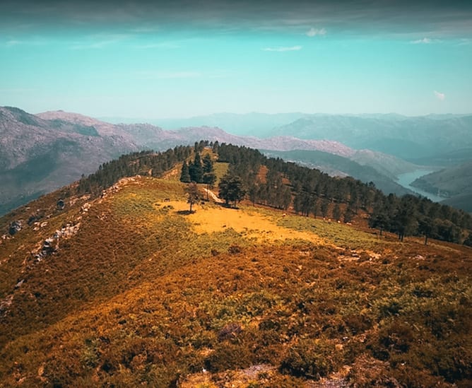
The Tibo Viewpoint is an absolute wonder, and one of the best well kept secrets in Gerês, perhaps due to its location far north, away from the popular village of Gerês.
This viewpoint offers an open view over Serra da Peneda and the Laboreiro valley, including the Alto Lindoso reservoir. So, so beautiful, really a must do in Gerês!
How to get there: by car – you can even park right next to the viewpoint.
GPS coordinates: 41°55’39.2″N 8°14’15.6″W
Altitude: 800 meters.
Fafião Viewpoint
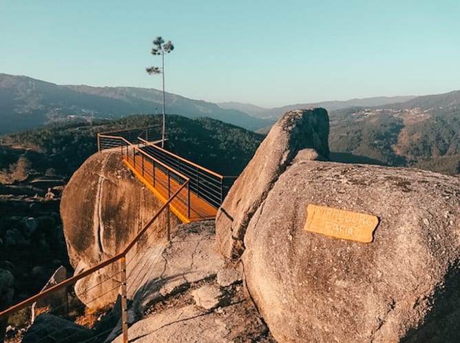
The Fafião Viewpoint is one of the least known viewpoints in Gerês (quite a mystery if you ask me, as it is very pretty!). After all, it is easily accessible and it has a beautiful view of the surrounding mountains. It also has a very well constructed and safe walkway that makes the pictures even prettier.
How to get there: park the car in the village of Fafião and follow the short trail that leads to the viewpoint, starting in the picnic area of the village.
GPS Coordinates: 41°42’21.5″ N 8°05’26.4″ W
Altitude: 800 meters
Pedra Bela Viewpoint
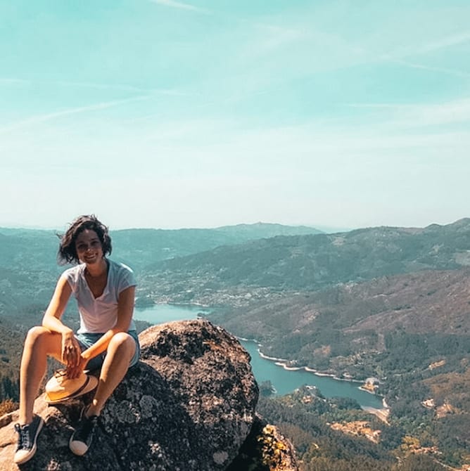
Perhaps the most popular viewpoint in Gerês, and rightfully so: the view of the Cávado river and the surrounding mountains is breathtaking. Moreover, it is easily accessible. Therefore, going to the Pedra Bela Viewpoint is really a top choice in any what to do in Gerês list.
How to get there: you can take the car right to the viewpoint, but it’s not easy to park up there. Leave the car 100 / 200m away from the viewpoint and do rest on foot.
GPS coordinates: 41°42’56.6″ N 8°09’11.7″ W
Altitude: 1100 meters
Boneca Viewpoint
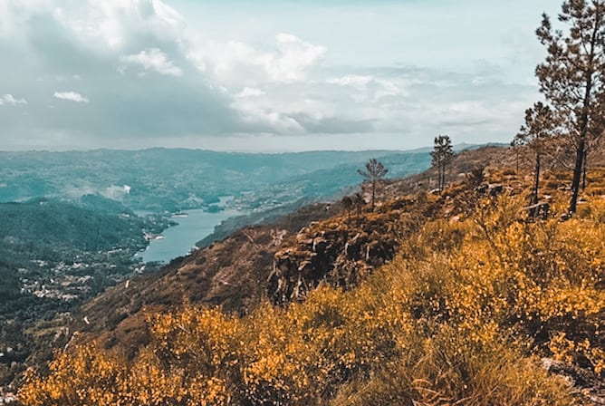
Very close to Fraga Negra viewpoint, Boneca viewpoint has a better view due to its higher location. If you wish to contemplate the full landscape of Gerês river, visiting Boneca viewpoint should be on your list of what to do in Gerês: your eyes will wander from Portela de Leonte until the reservoir of the Caniçada dam.
How to get there: it’s not possible to take the car to the viewpoint. As soon as you notice that you can’t go further, park and do the rest on foot (10 minutes, in total).
GPS coordinates: 41°43’38″N 8°10’18″W
Altitude: 750 meters
Fraga Negra Viewpoint
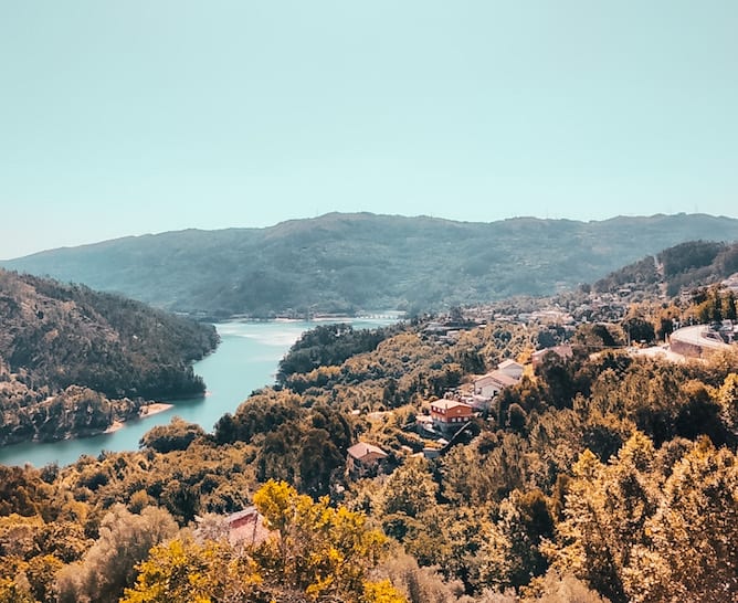
Located halfway the slope, this viewpoint provides a pleasant view over the reservoir of the Caniçada dam to the south, and the Gerês river valley to the north. It is not as impressive as the other viewpoints on this list but it is so nearby that it would be a pity to miss it.
How to get there: it’s not possible to take the car to the viewpoint. When you see you can’t go further, park and walk the rest (10 minutes, in total).
GPS Coordinates: 41°43’37.07″ N -8°10’6.23″ W
Altitude: 575 meters
Junceda Viewpoint
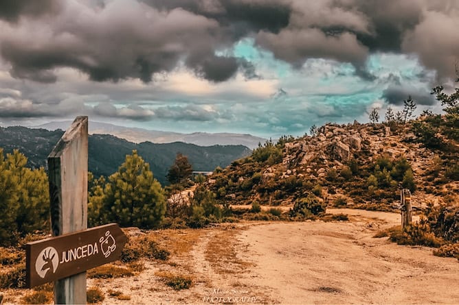
From the top of the Junceda Viewpoint, you can admire the Gerês valley, the village of Gerês, and all the surrounding landscape. Near the viewpoint, you’ll find the Junceda guardhouse, which is the starting point to the trail PR11 – Silha dos Ursos trail.
How to get there: through a 2.5 km dirt road, signposted at a junction with the road that connects Campo do Gerês to Vila do Gerês (M-533).
GPS coordinates: 41 44.510′ N 008 10.210′ W
Altitude: 915 meters
Tip: if you’re into hiking, one of the best ways to discover the best viewpoints in Gerês is by doing the PR6 trail – The Viewpoint Trail, that runs along the west slope of the village of Gerês. This trail has approximately 10 km in length and will take about 5 hours to complete. While you’re doing it, you’ll visit the Junceda Viewpoint, the highest peak of the trail, the Boneca Viewpoint, halfway the slope, and the viewpoints of Fraga Negra and Peneda da Freira, already close to Vila do Gerês. Something to keep in mind while planning what to do in Gerês, no? For more information, visit this website.
Best Waterfalls in Gerês
There are waterfalls in Gerês for all tastes and shapes: small and large, popular and hidden, easy or difficult to access. I wrote the list of my favorites and also a link for a great tour of the waterfalls and lagoons in Gerês, an excellent way to get to know this national park.
Portela do Homem Waterfall
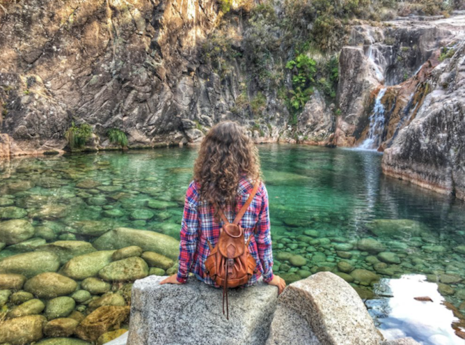
“What to do in Gerês?”: bathing in Portela do Homem Waterfall, of course! The crystal clear waters, with space for swimming, are perfect. You can also sunbathe in the surrounding smooth stones, it’s a great spot. One of the best waterfalls in Gerês, for sure!
How to get there: Portela do Homem Waterfall is located inside Mata da Albergaria, whose access costs 1,50€ / car. There’s a bridge above the waterfall but you can’t park there (the fine is 250€), so you have two options: either leave the car in the parking lot located 600m away, on the Portuguese side, or continue on the road N308 – 1, towards Spain (park in the Spanish side), and walk back to the waterfall.
GPS Coordinates: 41°48’14.8″N 8°07’41.7″W
Arado Waterfall
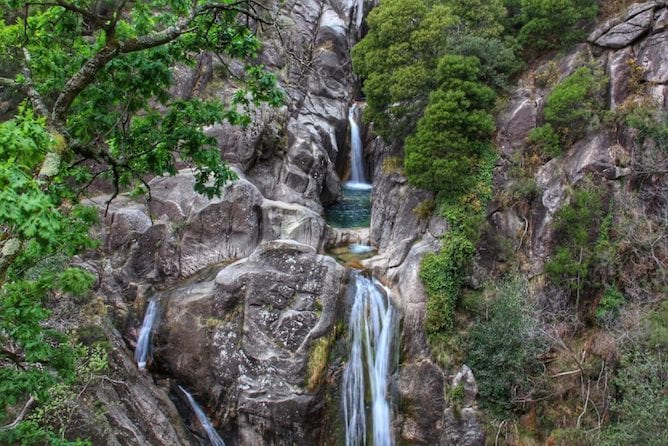
The Arado Waterfall is one of the best waterfalls in Gerês. With an impressive height of 900m, the waterfall forms small lagoons along its fall. It’s gorgeous!
Don’t be alarmed if you get there and find a crowd waiting for you: the best time to explore this spot is in the early morning or in non – summer months.
On the other hand, it is not easy to reach Arado waterfall, but I’ll tell you how to get there.
How to get there: park next to the rocas viewpoint and take the dirt road until the bridge over the Arado river. From there, climb to the Arado waterfall’s viewpoint and amaze yourself to the fall of the waters. The steps are, sometimes, high and irregular, so it’s not an advisable walk for elderly or for those with limited mobility. To access the bathing area, return to the place where you left the car and go up an inclined slope until the natural lagoons.
GPS Coordinates: 41°43’27.1″ N 8°07’47.7″ W
Tahiti Waterfalls
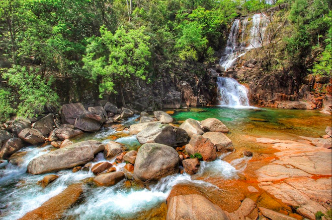
The Tahiti Waterfalls are amongst the prettiest waterfalls in Gerês. They form a kind of granitic amphitheatre whose stage is a lagoon, where you can take a very pleasing bath.
However, they aren’t easily accessible or safe, for that matter, since the rocks are very slippery. The absence of any kind of protection or vigilance systems lead to frequent accidents in this waterfall.
Nevertheless, the Tahiti waterfalls have to be in the list of what to do in Gerês. Overall, it’s worth going there, but with caution and a good pair of mountain shoes.
How to get there: take the CM1276 road that connects Vilar de Veiga to Ermida. You’ll find a small junction on your right with a sign to Cabril. Follow it until you find a wooden bridge over the Arado river. Park the car and walk the rest.
GPS Coordinates: 41°42’15.4″N 8°06’34.6″W
Pincães Waterfall
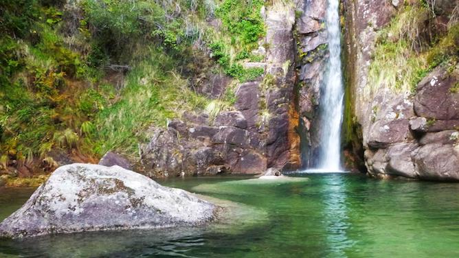
The Pincães Waterfall should definitely go on your list of what to do in Gerês if you, like me, don’t enjoy summer crowds. This waterfall in Gerês is really beautiful, forming an almost perfect circle with a large granite stone in the center, like a fantastic island. It is easy to get there.
How to get there: park the car in the village Pincães and walk 2 km (more and less 15 / 20 minutes).
GPS Coordinates: 41°42’58.7″N 8°03’34.6″W
Cela Cavalos Waterfall
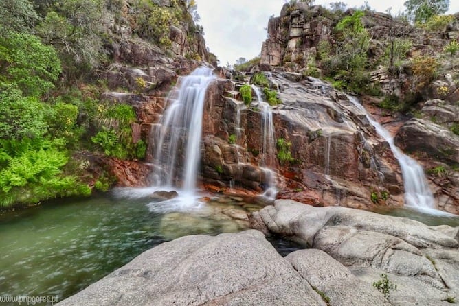
The Cela Cavalos waterfall is not as busy as others on the list due to its location, to the sides of Montalegre, in Gerês National Park. However, it has earned a spot on my what to in Gerês list not only for its natural beauty but also for the trails that give access to it.
How to get there: park the car in the Chapel of Santa Luzia, in the village of Cela, accessible from the road M308. Next, follow a dirt track of 2 km to the Cela Cavalos waterfall (20 / 30 minutes by foot).
GPS Coordinates: 41°45’39.1″N 7°59’12.6″W
Lagoons of Mata da Albergaria’s Waterfalls
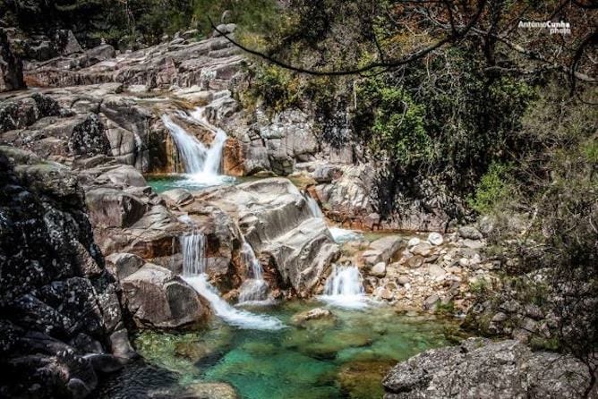
Visiting Mata da Albergaria, a protected forest, is part of any list of what to do in Gerês, and rightfully so. It is a secluded place where cars are not allowed to stop and hence you can find nature in its original form. And, since you are there, take some time to swim in the waterfalls of the Lagoons of Mata da Albergaria. You’ll not find many people, and the way to get there is idyllic.
How to get there: leave the car in the parking lot of Portela do Homem (next to the Spanish border) and, from there, walk 2 km (around 20 minutes). The trail is very beautiful, passing through three bridges and parts of the famous Geira Romana, which I write about on the Trails in Gerês’ section of this same article.
GPS Coordinates: 41°47’43.4″N 8°08’09.4″W
7 Lagoons’ Waterfalls
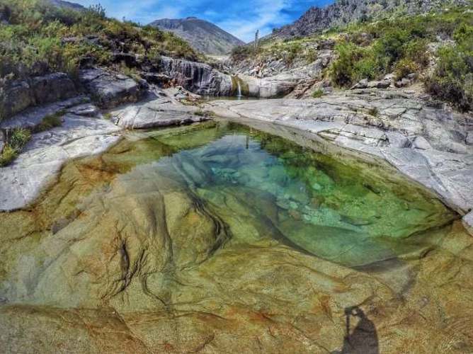
Arriving at the 7 Lagoons’ Waterfalls is not for the fainted hearts as it requires to do a trail of 6 km, which probably explains why they are relatively unknown, even though they are among the best waterfalls in Gerês. Some of the lagoons allow a proper diving, whereas others have slightly inclined stones, that allow you to enter slowly in the water.
Beware of the sunlight, since the lagoons or the trail don’t have many shades. Don’t forget to take a hat and a good sunscreen.
How to get there: there are several ways to get to the waterfalls of 7 Lagoons’ Waterfalls, but the quickest way is to park in Xertelo and make hike the trail of 7 Lagoons (5 km in length, around 1h30). You can, also start at Misarela’s bridge, between Montalegre and Vieira do Minho, doing a hike of 15 km (about 4 hours).
GPS Coordinates: 41°45’32.7″ N 8°01’37.4″ W
Waterfall of Poço Azul
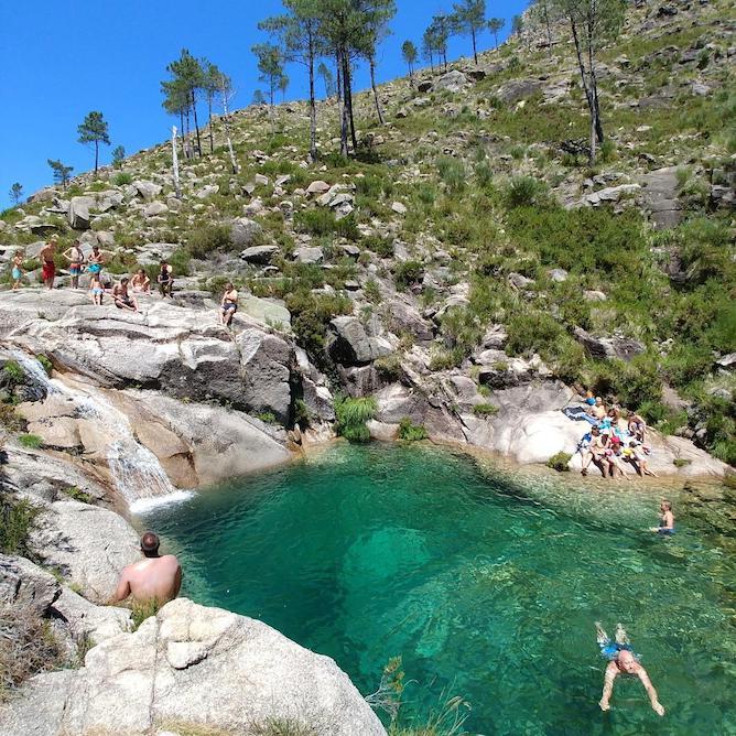
Poço Azul is deep, remote and gorgeous; a secret hidden in Gerês National Park. It has the advantage of having a riverside forest with beautiful oaks, that provide shade in hotter days. There’s only one way to get there, which is to walk, walk and walk; but, definitely, worthy of a spot in my list of what to do in Gerês.
Access: walk from the Arado Waterfalls to the Waterfall of Poço Azul, in a circular trail of about 10 km.
GPS Coordinates: 41°44’03.8″ N 8°06’27.5″ W
Beautiful Towns and Villages in Gerês
Castro Laboreiro
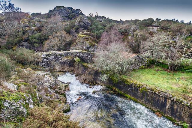
Due to its remote location, in one of the most north-western points of Gerês National Park, the village of Castro Laboreiro kept its traditions intact, which is quite visible to anyone who visits it.
In Castro Laboreiro you should visit the ruins of the castle from the XII century, the Manueline pillory, and the old bridge. You should also take my advice and go a bit further: discover the old community ovens (now abandoned), the funeral monuments and the Roman bridge of Cava Velha (3 km away from the town). The landscape is granitic, harrowing, heartbreaking.
Where to stay in Castro Laboreiro: there are two a-ma-zing hotels in Castro Laboreiro called Hotel Castrum Villae and Just Nature Guesthouse.
Soajo
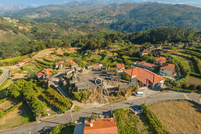
Soajo is one of the most famous villages in Gerês due to its 24 granaries. The oldest dates from 1784! A pillory can be found in the center of the village with an anthropomorphic symbol: essentially, a man eating a slice of bread.
Its magnificent granaries, the well-recovered houses and the pillory definitely place Soajo in this list of what do to in Gerês.
Where to stay in Soajo: I love Casas do Cavaleiro Eira, which I already mentioned on my article about the best hotels in Gerês. If you are looking for something more sophisticated, then I highly recommend Ribeira Collection Hotel, in Arcos de Valdevez (a 30 minutes drive away).
Lindoso
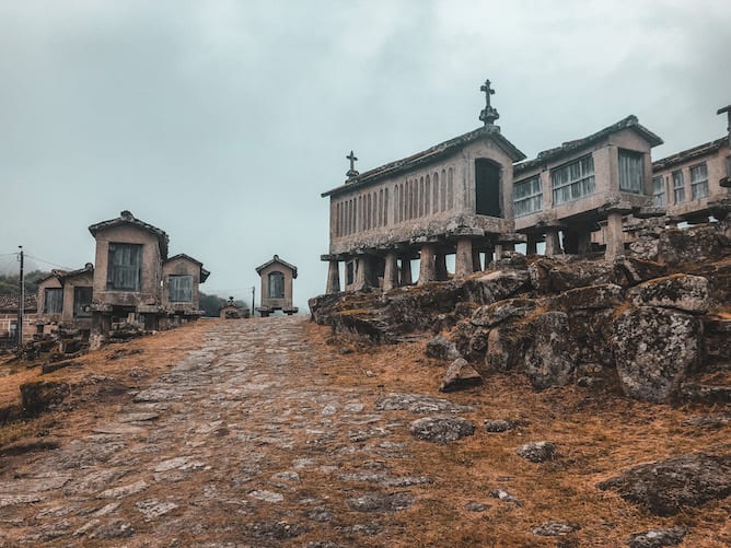
I’ve spotted Lindoso by mere chance while driving the national road 304-1. Suddenly, I saw the ruins of a castle peeking out my car window. I stopped the car and went to check out what turned out to be the castle of Lindoso (the entrance is free), that dates to the XIII century.
Leaving the castle, go around it either by the right or left, and discover one of the most beautiful secrets in Gerês: espigueiros, granite structures used by the population to dry corn. There are about 50 or 60 espigueiros, and, in my opinion, a lot more impressive than the ones in Soajo.
Here, you’ll run into one of the entrances to Gerês National Park, the door of Lindoso. It has a small center that provides lots of information on the region.
Where to stay in Lindoso: there is no accommodation in this town, but there is a beautiful rural house in the village of Parada, right next door, called Casa da Fecha.
Sistelo
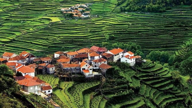
The village of Sistelo is not located exactly inside the National Park of Peneda-Gerês. However, I think it deserves a spot on the list of what to do in Gerês because it has some of the most beautiful trails of the region, which is an activity anyone will want to do here. Find more information on these trails of Sistelo in the Trails’ section on this very article.
Where to Stay in Sistelo: in Sistelo there are two suuuuper cute rural houses called Casa do Beijinho and Casa do Ramiscal.
Pitões das Júnias
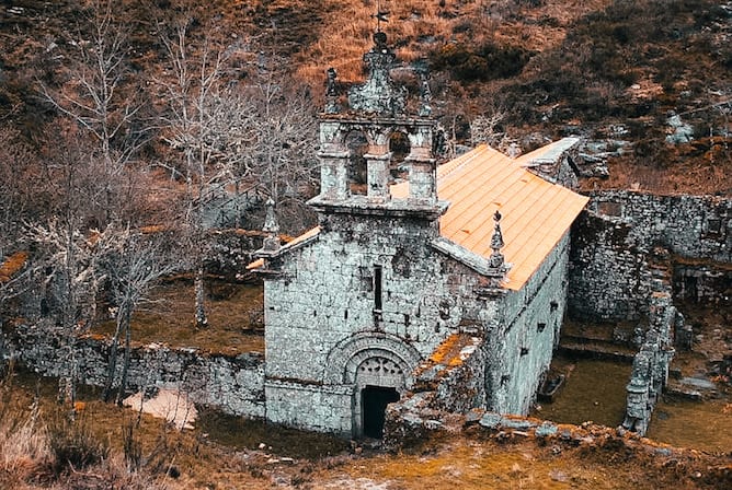
If you’re looking for some peace and isolation, head up to Pitões das Júnias, one of the historical villages on the eastern side of Gerês National Park. Here, walk 2 km south of the village, until the Monastery of Santa Maria das Júnias. Though in ruins (only the beautiful church stands), it remains as one of the most impressive records of the old Cistercian orders.
From the ruins of the Monastery, walk until the viewpoint of the waterfalls of Cascata de Pitões de Júnia. No doubt, one of the best suggestions of what to do in Gerês.
Where to Stay in Pitões das Júnias: Casa do Preto, a modest guesthouse with a fabulous restaurant (true story – I am Portuguese and we don’t mess around with food).
Santuário da Peneda do Gerês
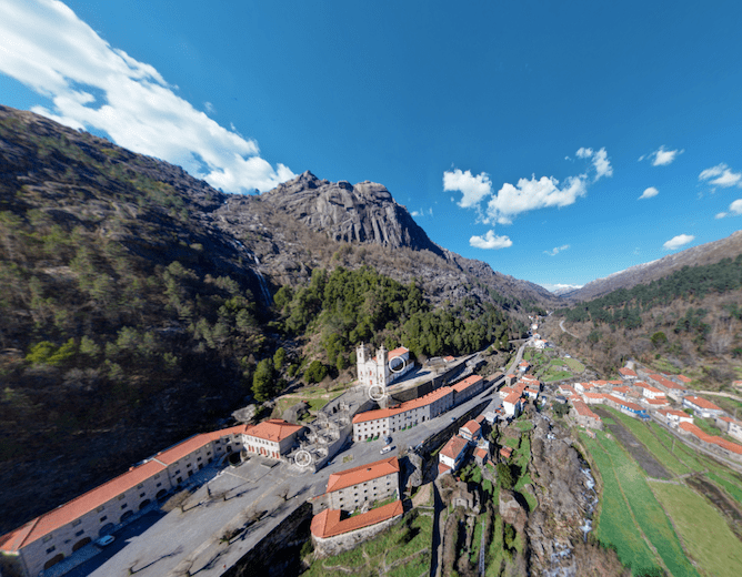
The 18th century Peneda Gerês Sanctuary is an impressive monument to the Catholic faith in the middle of the mountainous landscape, with a monumental staircase and twenty chapels with biblical scenes. In the first week of September, an important pilgrimage from Alto Minho takes place here, already known for its great religious parties.
In the vicinity of the Peneda Gerês Sanctuary there is a hotel with the same name, perfect landing to discover the neighboring villages and local trails such as PR 8 – Mistura das Águas Trail.
Where to stay: very close to the sanctuary is Casas da Peneda, a beautiful, beautiful rural tourism unit.
River beaches in Gerês
Most of the river beaches in Gerês are located in the reservoir of the Dam of Caniçada. In its vast majority, they are quite accessible, with parking lots, restaurants and coffees nearby, and the ability to practice water sports. Some – just a few – are located away from the mainstream circuit, therefore with less people. I leave these to the end of this section on what to do in Gerês.
River Beach of Alqueirão
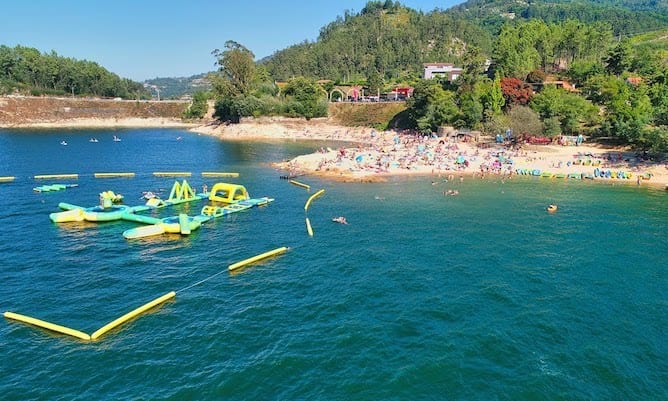
One of the best river beaches in Gerês is Alqueirão Beach, distinguished last year with a golden star. Of easy access, right in the left of the bridge that goes to the Vila do Gerês, this beach offers not only the possibility of swimming but, also, the commodities to practice water sports with your family. You should also take the opportunity to give a nice walk around the reservoir of Caniçada, exactly where the beach situated.
GPS Coordinates: 41°40’45.2″ N 8°10’34.6″ W
Barca River Beach
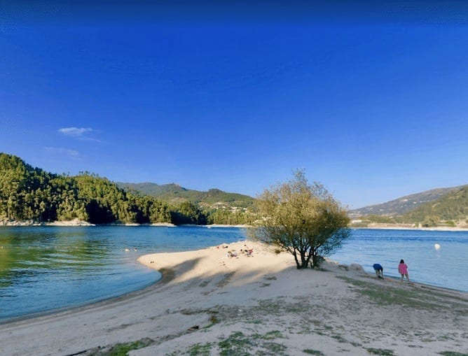
Another activity on this what to do in Gerês list is taking the car and head up to Barca river beach, close to the Sanctuary of São Bento da Porta Aberta. With great accesses (you can park practically in front of the beach), a parking lot, picnic tables and restaurants, this beach is one of the easiest ones to visit in Gerês.
GPS Coordinates: 41°40’55.1″ N 8°11’11.2″ W
River Beach of México
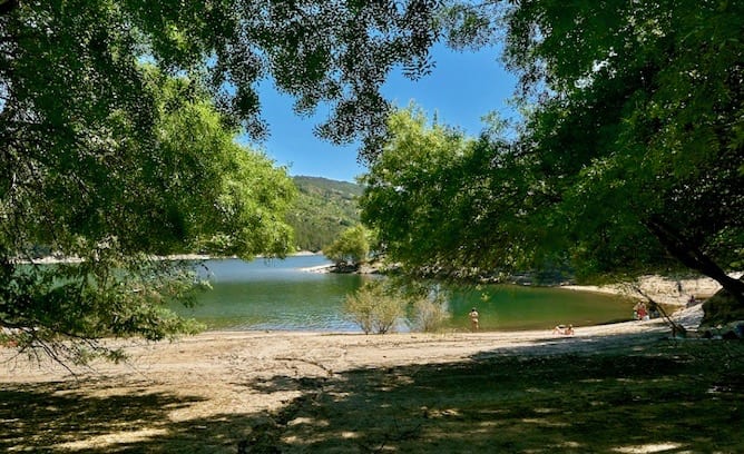
The beach of México (a nice name to one of the best river beaches in Gerês) is located in the reservoir of the dam of Caniçada. It’s a beautiful beach, with crystal clear waters, and the difficult access keeps the crowds away. Nevertheless, in the past few years, there have been several complains of an excess of jet skis in the area, which unfortunately make the beach noisy.
GPS Coordinates: 41°40’45.5″ N 8°09’25.7″ W
Ipanema river Beach
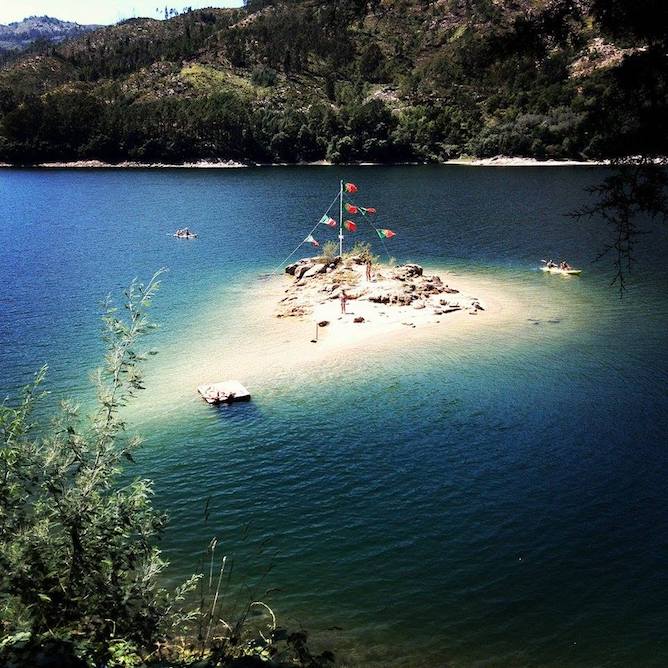
Ipanema beach, also known as the Dam Beach, is famous for having a small and lovely island named the Beach of the Island of Gerês. Both beaches are quite versatile since they allow its visitors to bathe or slide in canoe or pedal.
This river beach in Gerês is easily accessible, with lots of restaurants and coffees nearby, as well as a parking lot.
GPS Coordinates: 41°41’25.7″ N 8°10’25.0″ W
River Beach of Vilarinho das Furnas
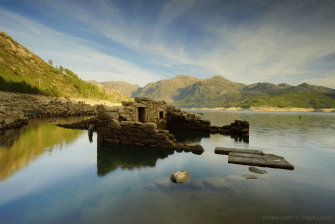
Away from the busy areas of Caniçada Dam, you’ll find the river beach of Vilarinho das Furnas. Created at the same time as the dam of Vilarinho das Furnas, it has practically no tourists – so, don’t expect to find the usual beach infrastructures around. However, the silence and the harmony with nature largely compensate for the absence of commodities.
Besides, concerning what to do in Gerês, let me tell you that one of the best things to see, especially in Summer, are the ruins of a submerse village, precisely in this beach.
To get there, drive to the dam of Vilarinho das Furnas, and walk the remaining route (around 2 km).
GPS Coordinates: 41° 46′ 1.0524″ N 8° 12′ 4.0392″ W
Hiking Trails in Gerês
Gerês National Park is huge so it is literally impossible to list, in this article, all the trails available. That being said, I’ll suggest some of my favourite trails, in case you’re searching what to do in Gerês.
Geira Romana (former Roman path)
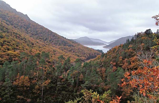
In the pristine Mata da Albergaria, a protected wood in Gerês National Park, you’ll find a well-preserved section of the ancient Via Nova, a Roman road that connected the cities of Bracara Augusta (currently Braga) and Austurica Augusta. These are thousand-year stones that tell us the story of a time long gone, that seems to keep embracing us during the walk, in the shadow of magnificent trees.
I recommend the route between the mile XXVIII, in Campo do Gerês, and the mile XXXIV, next to Portela do Homem. The mile XXVIII begins at the fork between the road that ads to the dam of Vilarinho das Furnas and the dirt road that leads to Portela do Homem. The trail of Geira Romana continues to the left of this road.
Distance: 17 km.
Difficulty: moderate.
Trail of the Walkway of Sistelo
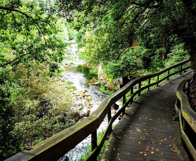
The walkway of Sistelo is, in fact, one of the shortest in Gerês, with a length of 1,8 km. However, since they are also part of the Ecovia do Vez – that one with a length of 32 km – I suggest you to extend the walkway of Sistelo by some kms. For example, by walking between the town of Sistelo and the medieval bridge of Vilela, on a trail of 11 km.
Distance: 22 km (to go and to come back).
Difficulty: easy / moderate.
Trail of the Misarela bridge
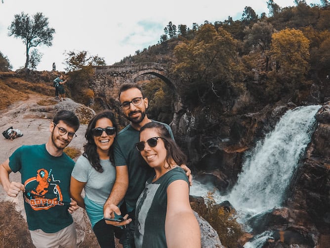
I run into this trail practically by chance, while passing some days with friends in the region. The trail starts in Vila Nova (next to the futsal beach) and it ends exactly at Misarela bridge, also known as the Bridge of Devil.
On that day, we ended up sharing a picnic on a plain rock, right next to the bridge of Misarela. It was wonderful!
Distance: 12 km.
Difficulty: Easy / Moderate.
Castro Laboreiro (Castrejo Trail)
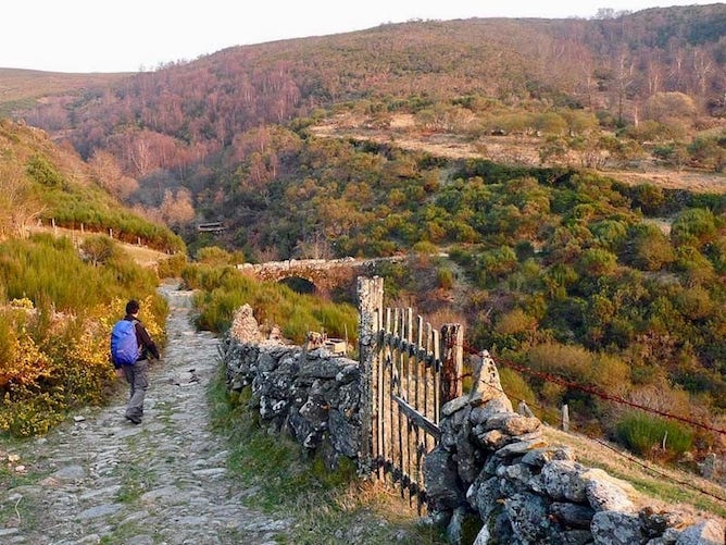
One of the most wonderful things to do in Gerês are the thematic trails, such as the trail of transhumance in the region of Castro Laboreiro. Let me explain: in the past, shepherds used to move their flocks between the Brandas, located in places with lower quotas , and the Inverneiras, in places with higher quotas, to better feed and protect them. The castrejo trail of Castro Laboreiro is a homage to the transhumance, a human phenomena with hundreds of years.
It has also the advantage of being a circular trail, that start and finishes in the town of Castro Laboreiro.
Distance: 17 km (circular trail).
Difficulty: moderate.
Vezeira de Fafião Trail
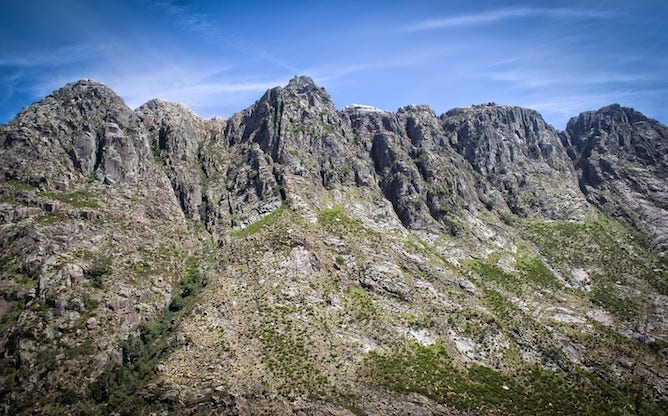
I left for last the most difficult trail in Gerês, the Trail of Vezeira, that encompasses an area of badios (I’ll explain in a minute). Vezeira consists of the joining of herds from the same village, but of different owners, to be grazed in common land, badios. The members of the Vezeira must conduct this collective herd at turns, and, for that reason, it’s possible to find small huts scattered along the way, that served as shelters for these shepherds.
If you, like me, prefer the granite desolation of this area to the exuberance of the fluvial Gerês, then you will fall in love with this bare and stripped trail, with no distractions other than the vast mountains. Something to take in account while deciding on what to do in Gerês, no?
This trail, in Gerês, is difficult, for the distance covered (20 km) as well as for the altitude variation, between the 500 m and the 1260 m. But it’s so gratifying!
Distance: 20 km.
Difficulty: Elevate.
Save this article for later:

